


The Stellingwerven
(51.3 km)
If you like history then this route is definitely for you. You will pass through several villages that all have their own rich history. You will pass through the villages of Vledder, Frederiksoord, Wilhelminaoord, Steggerda, de Blesse, Noordwolde, Oosterstreek and Zorgvlied. So plenty to experience and see during this route!
Parking
You can park at Bezoekerscentrum Grenzeloos Doldersum (Boijlerstraat 12 8386XE Doldersum)
Signposting
This route is not signposted. You can download it via the 'Download' button at the top. Please note that the route is therefore not very detailed.
Food & drink
Would you like to have something to eat or drink during this cycle tour? You can do so at several catering establishments located along the route.


You are going to see this
-
Doldersum
Doldersum
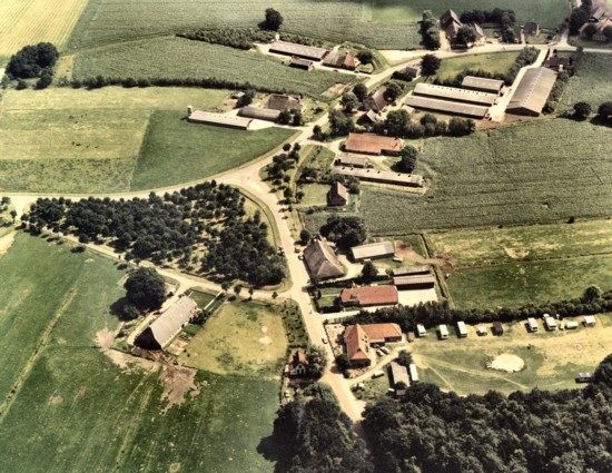
Doldersum is a small esdorp and possibly the oldest village in the former municipality of Vledder. Nearby are "the Major" and "the General ", two old burial mounds from the late Stone or Iron Age. North of Doldersum lies the Doldersummerveld.
-
-
Grave mounds the General & Major
Grave mounds the General & Major
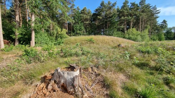
In the late Stone Age and Iron Age, the dead were buried in burial mounds. Drenthe still has many hundreds of them. Close to the Koelingsveld/Bouwersveld are two burial mounds (the Major and the General (is the largest and oldest)) in Doldersum.
-
Stork Avenue
Stork Avenue
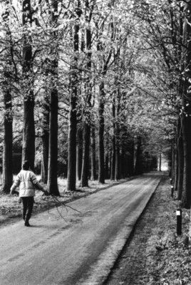
The name of this street probably comes from the stork. In Drenthe, a stork is a störk or stork. In the past, there were several stork nests in the trees along the road.
-
Solweg
Solweg
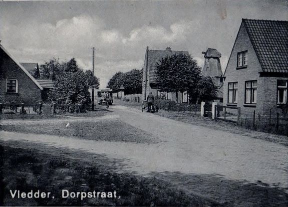
Where the name comes from cannot be said with certainty. The name Solweg could be explained by the fact that it opens onto the sollen: round fens with shallow water. Solweg used to be a clinker road, full of potholes and holes. Later, the road was paved
-
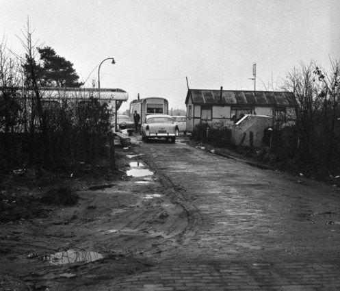
Doldersum trailer park
Doldersum trailer park
On Solweg from Vledder to Doldersum, from about 1930 onwards, there was a caravan camp. The camp was extremely spartan; there was hardly any paving, no electricity, no lighting and no toilet facilities.
-
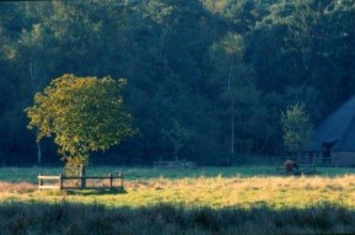
Vledderhof country estate
Vledderhof country estate
The De Vledderhof estate is located north of the village of Vledder. Stately avenues and inviting footpaths lead here through varied woodlands and scenically beautiful cultivated land plots with several pools and ponds.
-
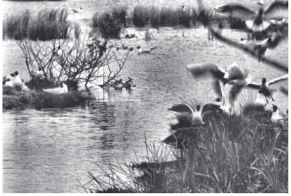
Seagull colony
Seagull colony
In the mid-50s, many seagulls could be found at the adder hole (fen further down the road). To be found on the Bouwersveld and Koelingsveld. At some point, they moved to other ven. This fen is therefore called gull colony.
-
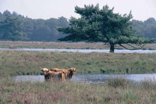
Bouwersveld and Koelingsveld
Bouwersveld and Koelingsveld
Amid an environment rich in forests and nature reserves, Bouwersveld and Koelingsveld form one nature reserve. Few paths run through the area, making it barely accessible to the public.
-
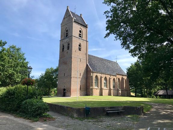
Vledder
Vledder
Vledder is an esdorp. in the municipality of Westerveld, in the Dutch province of Drenthe. Vledder, like many other Drenthe brink villages, has a long history.
-
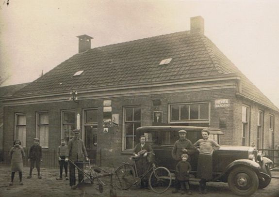
Dorpsstraat Vledder
Dorpsstraat Vledder
Dorpsstraat as a name only came into existence due to name changes in 1960-1961. It used to be Wijk I. Later, it was Voorstraat. It was also called the Hoofdstraat. The building that now houses the Chinese served as a vicarage for many years.
-
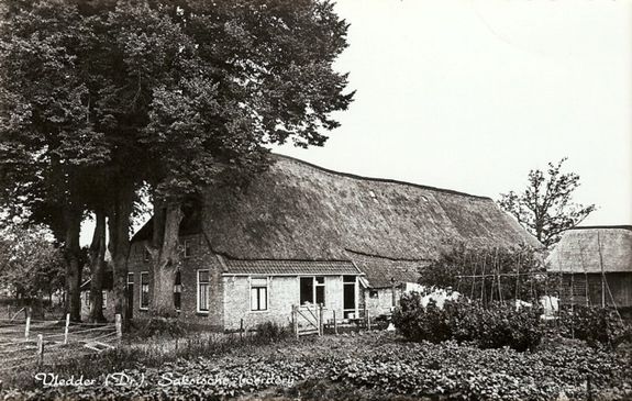
Oosteind
Oosteind
The name of this street has not changed over the years. The eastern part of Vledder used to be called "Oosteind", and on this road stands 1 of the oldest farms in Vledder. This farm was built in 1701.
-
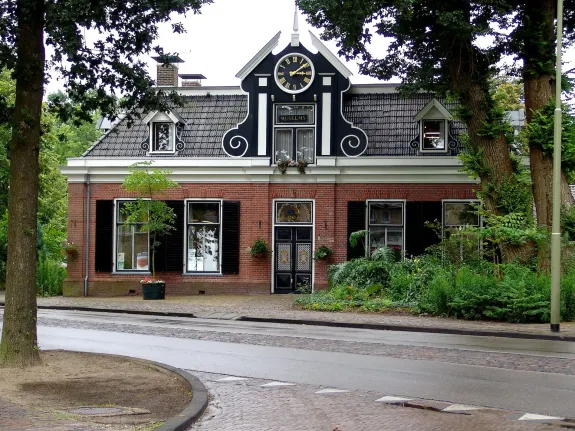
Museum False Art
Museum False Art
Being conned into your art purchase. It happened to Henk and Erna Plenter several times. In the late 1990s, they moved their private collection of paintings and contemporary glass art to the former Raadhuis in Vledder. The collection was supplemented with paintings by artists from Drenthe.
-
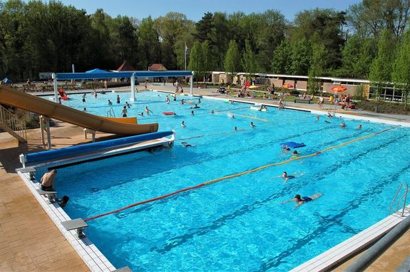
Bosbad Vledder
Bosbad Vledder
Swimming is for everyone who enjoys exercising in the water. Recreational swimming is open to everyone. During opening hours, everyone can swim freely at their own pace and in their own way. Lane swimming and games go hi...
-
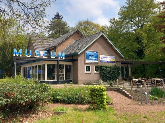
Miramar sea museum
Miramar sea museum
Nowhere in Drenthe can you find the sea, except in Vledder. Since 1965, Miramar sea museum, founded by Ms Jeanne Warners, has been here. She collected her impressive collection of shells, corals and other marine animals from over eighty countries.
-
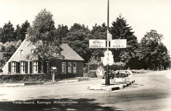
Queen Wilhelmina Avenue
Queen Wilhelmina Avenue
Around 1832, this was the "New Colony Road from Noordwolde over Frederik-oord". It is also referred to as the "Noordwoldigerweg", and around 1900 we see the name "Queen Wilhelmina Avenue". The street runs from Frederik-oord to across the border with Friesland.
-
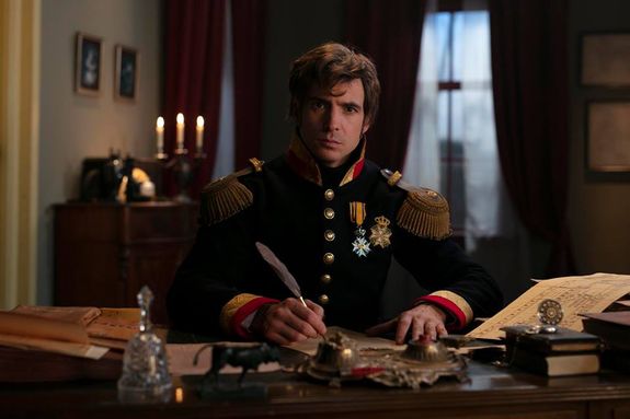
Museum The Trial Colony
Museum The Trial Colony
SEE - EXPECT - ENJOY Welcome to this special experience museum that takes you back in time some 200 years. Here you will discover the origins of our welfare state during a multimedia time travel. Experience the story of the first settlers.
-
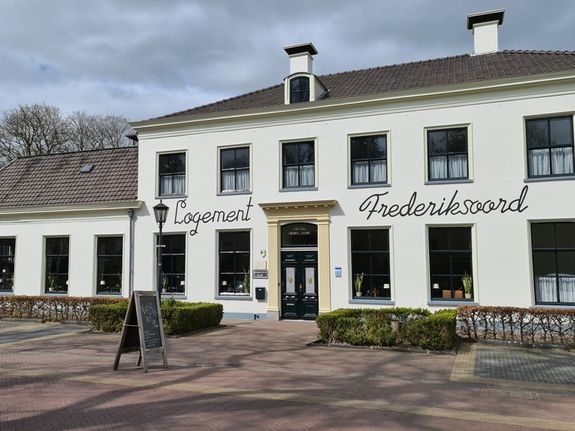
Frederiksoord
Frederiksoord
Frederiksoord is the oldest Colony of Weldadigheid. Frederiksoord was the site of Johannes van den Bosch in 1818 with carte blanche from King William I offering new opportunities to paupers from urban areas.
-
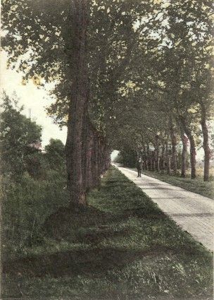
Mayor Wynoldyweg
Mayor Wynoldyweg
This road bears the name of Johan Albert Casper Wynoldy, mayor from 1876- 1906 of Vledder. However, it also used to be referred to as 'den grintweg van Frederiksoord naar Havelte'.
-
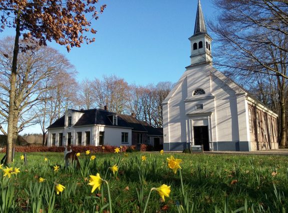
Colony church Wilhelminaoord
Colony church Wilhelminaoord
Characteristic white church with beautiful garden behind it surrounded by trees and an atmospheric outbuilding with wood-burning stove. The light is wonderful in this pretty, bright little church. Weddings, concerts and other beautiful events regularly take place here.
-
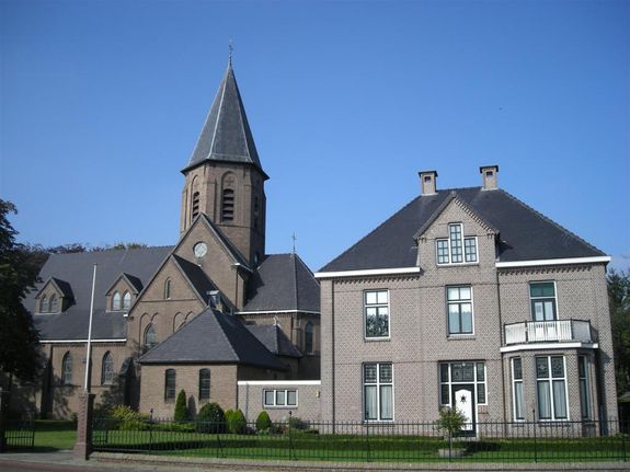
Steggerda
Steggerda
Steggerda is a regional village that originated in the Middle Ages on the Binnenweg from Oldemarkt to Noordwolde, a settlement axis on which Blesdijke, Peperga and Vinkega also originated.
-
De Blesse
De Blesse
De Blesse is a regional village that is indicated as a neighbourhood by the little water Blesse already on the grietenijk map of Weststellingwerf in Schotanus' atlas. It then still belongs to the village of Blesdijke.
-
Blesse bridge ramp
Blesse bridge ramp
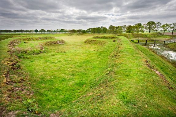
The Blessebrugschans is an entrenchment between De Blesse and Wolvega along the Linde river in the province of Friesland. The Blessebrugschans was part of the Frisian waterline during the Eighty Years' War.
-
Noordwolde-South
Noordwolde-South
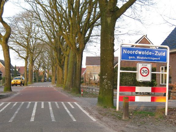
Noordwolde-Zuid (Stellingwerfs: Noordwoolde-Zuud, Frisian: Noardwâlde-Súd) is a town in the municipality of Weststellingwerf, in the Dutch province of Friesland. It lies south of the village of Noordwolde.
-
Noordwolde
Noordwolde
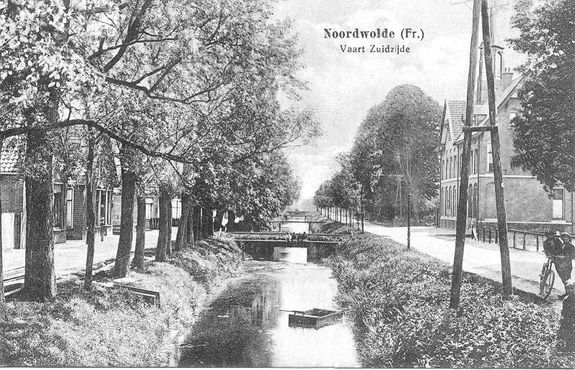
Noordwolde is a hospitable village known as the rotund village. Just outside Noordwolde, Friesland, Drenthe and Overijssel meet at the three-province point. Part of Noordwolde's outlying area belonged to the Colonies of Weldadigheid.
-
-
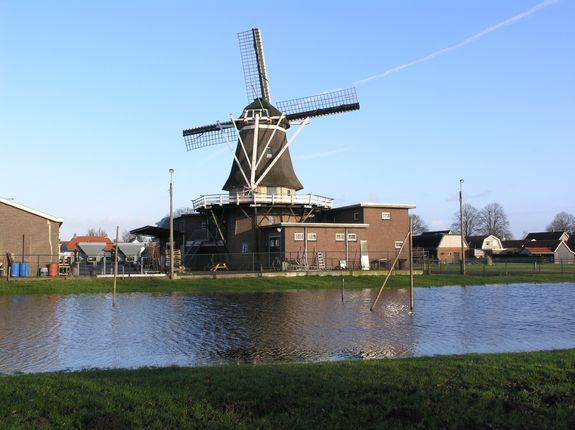
Windlust Noordwolde
Windlust Noordwolde
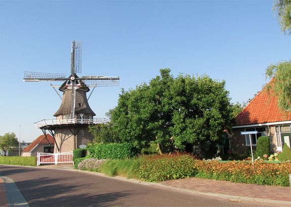
Noordwolde possesses a particularly beautiful and highly waisted mill. Because of this waistline, the cap sticks out a bit far. After all, it has to contain enough space for the upper wheel and catch. The designer of this mill was Anne Piers Fabriek. It was completed in 1859.
-
Monument on the Dwarsvaartweg
Monument on the Dwarsvaartweg
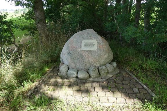
On 30 June 1942, a Canadian Halifax bomber crashes here on Dwarsvaartweg in a massive conflagration. The eight occupants lose their lives in the process. They find their final resting place at the cemetery in Noordwolde. They gave their lives.
-
Oosterstreek
Oosterstreek
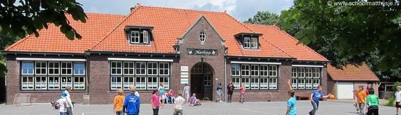
Oosterstreek is a village in the municipality of Weststellingwerf. It is located northeast of Noordwolde on the road to Boijl and a stone's throw from Drenthe. The village began as a hamlet, but has since grown into an independent village.
-
Boschoord
Boschoord
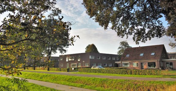
Boschoord is a hamlet in the municipality of Westerveld in the Dutch province of Drenthe. The hamlet is located near the border with the province of Friesland between Boijl and Doldersum. The origins of Boschoord are linked to the history of the Maatschappij
-
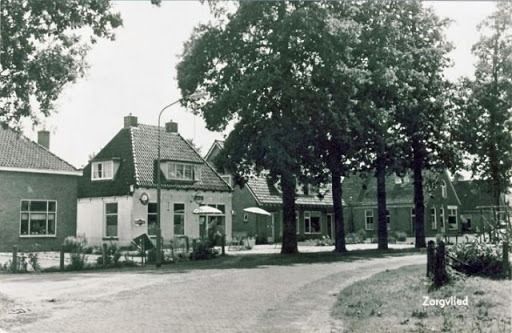
Ruyter de Wildtlaan
Ruyter de Wildtlaan
In 1859, the land and school were sold to J.F.de Ruyter de Wildt, a distant relative of the famous admiral. De Ruyter de Wildt built, among other things, the villa 'Castera Vetera', which was completed in 1862.
-
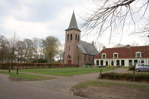
Zorgvlied
Zorgvlied
Zorgvlied is a village in the municipality of Westerveld and belonged to Diever until 1998. It lies northwest of Diever and northeast of Vledder. In a worse sense, northwest of Wateren and north of Doldersum, against the Drents-Friesian border.
-
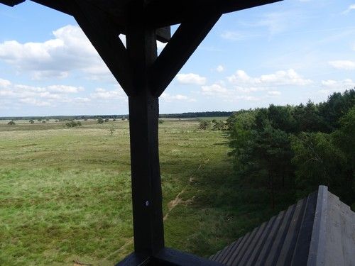
Watch tower Doldersummerveld
Watch tower Doldersummerveld
Lookout tower Doldersumse Veld, better known as the 'Polish' lookout tower. From the watchtower you have a great view over the heathland. At the beginning of July, the fields are yellow due to the flowering...
-
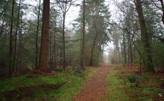
Boschoord estate
Boschoord estate
Landgoed Boschoord is a special area on the southern flank of the Drents-Friese Wold. It covers 650 hectares and consists largely of forest, but there are also peat bogs and fens with high nature values.
-
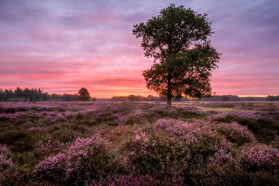
Doldersummerveld
Doldersummerveld
A vast, wet heathland reserve, located on the flank of the brook valley of the Vledder and Wapserveensche A, north of Doldersum.
-
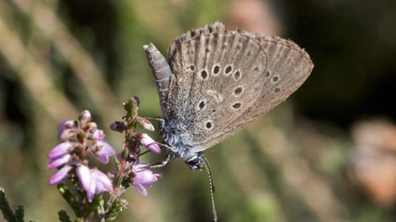
Butterfly sanctuary
Butterfly sanctuary
Drenthe's Doldersummerveld has been declared a butterfly reserve by De Vlinderstichting. The area is home to rare butterflies and the manager, Stichting Het Drentse landschap.
-
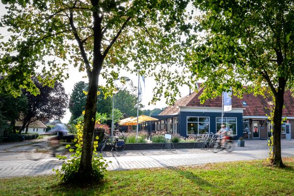
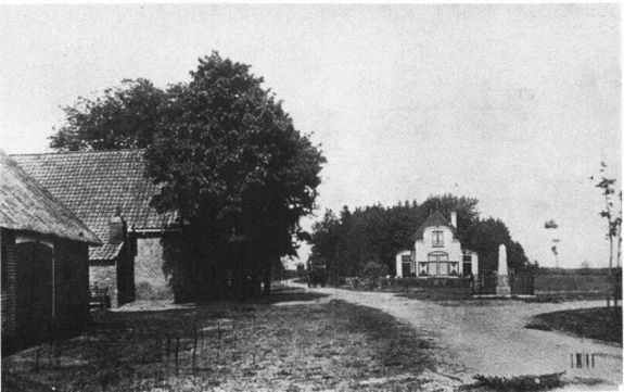
End point Visitor Centre Boundless Doldersum
End point Visitor Centre Boundless Doldersum
We hope you enjoyed the surroundings, come and enjoy a snack or drink in the restaurant at Boundless. Current opening hours can be found on the site of grenzeloos-drenthe.nl (at the bottom of each page).

Description
Additional info
- The De Stellingwerven route starts at the visitor centre Boundless Doldersum. You can park your car in the car park and start the route from here. Inside the visitor centre, you can find more information about the nearby area, more cycling and walking routes and ask any questions you may have.
- The starting point is in the village of Doldersum. Doldersum is an esdorp in the municipality of Westerveld, in the province of Drenthe. The village has about 120 inhabitants. Doldersum is located northwest of Dwingeloo and northeast of Vledder. Doldersum borders the Drents-Friese Wold National Park. The Vledder Aa, the stream near Doldersum and the Doldersummerveld, a heathland area managed by the foundation Het Drentse Landschap, are part of that park. The upper reaches of the Vledder Aa were rearranged in 2002 and 2003. The brook, which had been canalised in the early 1960s, regained its former course. The rich topsoil has been ploughed off. Now nature should develop again in the area between Doldersum and Wateren.
- The Doldersummerveld is a vast wet heathland reserve, located on the flank of the brook valley of the Vledder and Wapserveensche Aa, north of Doldersum. The field is part of the National Park Drents-Friese Wold. The wet heathland merges on the north side into a bumpy, former drift sand area, resulting in much variation in soil composition, water management and altitude. This is also reflected in the rich variety of flora and fauna.
- Next, you will pass by the Urn Field. Amid an environment rich in forests and nature reserves, the Bouwersveld and the Koelingsveld form one nature reserve. Few paths run through the area, making it barely accessible to the public. From the cycle path along the edge, however, the area is easy to overlook. The Koelingsveld contains an urn field with burial mounds from the late Bronze Age. Just outside the site are two burial mounds, known locally as "the General and "the Major". Scattered in the site are finds of flints.
- Continuing your way, you will pass through Vledder. Vledder is an esdorp. in the municipality of Westerveld, in the Dutch province of Drenthe. Vledder, like many other bog villages in Drenthe, has a long history. Several burial mounds and urn fields from the New Stone Age have been found in the vicinity of Vledder. Various prehistoric finds such as stone axes, amber and urns have been found.
- The name Vledder indicates a wet place. The village has two brinks, popularly called the large and small brink.
- Next, we arrive in Frederiksoord. Frederiksoord is the oldest Colony of Weldadigheid. In 1818, Frederiksoord was where Johannes van den Bosch, with carte blanche from King William I, offered those paupers from urban areas new opportunities. The beginning of a grand social experiment that is still visible in the landscape and on the buildings standing in this Colony.
- In spring 2019, Museum the Tasting Colony opened. Here, through a multimedia time travel, you will experience the origins of the Colonies of Weldadigheid and the real story of the first settlers who found a new future in Frederiksoord in 1818. The museum is located in the Huis van Weldadigheid Visitor Centre.
- We also pass through Wilhelminaoord. Wilhelminaoord is a colony village in the municipality of Westerveld, in the Dutch province of Drenthe. Wilhelminaoord was founded as a colony in 1821 by the Maatschappij van Weldadigheid, which started clearing land in south-west Drenthe and neighbouring Friesland and Overijssel in 1818. The place was named after King William I's mother, Wilhelmina of Prussia, who died on 9 June 1820. The society provided simple housing, a small patch of land for the underprivileged population from larger towns. Wilhelminaoord became a village for the colonists, as did Frederiksoord and Willemsoord.
- Wilhelminaoord is mentioned in various historical topographical sources under different names, such as Wilhelmina's Oort, Wilhelmina'soord, Wilhelminaasoord and during the twentieth century as Wilhelminaoord. Just across the Drenthe-Frisian border, north of Wilhelminaoord one finds the Frisian rock village of Noordwolde.
- From 2010, new construction will take place in the style of the old colony houses along the roads where old colony houses were previously demolished. This will restore the image of the former ribbon development.
- Next, you will pass through Steggerda. Steggerda is a regional village that originated in the Middle Ages on the Binnenweg from Oldemarkt to Noordwolde, a settlement axis on which Blesdijke, Peperga and Vinkega also originated. The grietijk map in Schotanus' 1716 atlas shows that the village consists of several parts. The west, the Overburen, lies on its own path quite far south of the Binnenweg. In the middle, there is quite a bit of development at the junction of the road and the canal - the Steggerdersloot, dug around 1608 - to the Linde, and in the east, north of the road, there is a long strip of development up to the village area of Vinkega. In addition, further south runs the Bovenweg, of which only a few fragments remain today.
- The Tegenwoordige Staat van Friesland reported in 1788: 'to the West of 't voorige Vinkega aan denzelfden vermaaklyken rydweg, has to the South good arable land, and to the North towards the Linde, first some arable and pasture land, and then, naby gemelden stroom, hay land. The church, without a tower, stands a little isolated to the north, and to the west of it runs the Steggerder Ditch from the Linde to the peat bogs; but because no peat of any importance is dug here anymore, this ditch is no longer navigable. The Steggerder neighbourhood, through which the church road runs, lies next to this ditch, pleasantly surrounded by trees; there is another neighbourhood, called Overbuuren, to the south of the Buitenweg, also surrounded by trees.
- On the map in Eekhoff's atlas, not much appears to have changed in 1850. Overburen does have a Roman Catholic church, whose churchyard dating from 1839 is still there. East of the canal stands the reformed church in the trees. It dates from 1739, but this is not noticeable because it was bricked up and greatly altered in 1903 to the design of B. Rouwkema. A new Roman Catholic church arrived on Binnenweg in 1922, designed by Wolter te Riele: a neo-Gothic cruciform church with an octagonal crossing tower.
- Next, we arrive at de Blesse. De Blesse is a regional village that is indicated as a neighbourhood by the little water Blesse already on the grietenijk map of Weststellingwerf in Schotanus' atlas. It then still belongs to the village of Blesdijke. To the north, near the Linde, Stadholder Willem Lodewijk built an entrenchment at the end of the 16th century. Its traces have long been visible in the landscape, but are no longer discernible now.
- After the country road from Wolvega to the south - partly along the Blesse water - became part of the national highway from Leeuwarden to Zwolle in 1828, the neighbourhood expanded and gradually outstripped the original village. Two cow and horse markets were held annually, which the primordial village of Blesdijke had never achieved. On the map in Eekhoff's 1850 atlas, the growth process seems to have only just begun. Behind the buildings along the road, a corn mill is indicated. It is mill De Mars, built in 1834. The eight-sided, thatched hull rises on a brick base with scaffolding. The sails were removed in 1927. The mill was restored using parts from an 1877 Black Haan mill.
- There was no church, but a reformed chapel was built on Steenwijkerweg around 1880: a simple, all-plastered hall. Especially from the end of the 19th century, the two sides of Steenwijkerweg became quite densely built with middle-class and working-class houses and a few business premises, including a café. Quite early on, a series of housing estates were built on Steenwijkerweg near the provincial border in 1921. On the east side, a new neighbourhood was developed behind the ribbon development after World War II, a district with quite a lot of public housing. De Blesse, incidentally, has not lost its character of elongated regional village. The parent village of Blesdijke did not experience this development, causing De Blesse to outstrip it.
- Also passing through Noordwolde. Noordwolde is a welcoming village known as the rock village, of which its modest population is secretly proud after all.
- Just outside Noordwolde, Friesland, Drenthe and Overijssel meet at the three-province point. Part of Noordwolde's outlying area once belonged to the Colonies of Weldadigheid. This society, founded by General Van den Bosch, is also known as the cradle of our Dutch welfare state and is on the Unesco World Heritage List.
- Leafy Noordwolde is located where the Drents Friese Wold gradually merges into the Linde Valley. Forests and heathland to the south and east; coulisse landscape and a meandering stream valley to the north and west of the drop.
A lively reed weaving industry emerged on this spot 200 years ago. Noordwolde was also the site of a reed weaving school, now home to the National Weaving Museum. Here you can learn all about the braiding industry from the region's past, but you will also find designer chairs of modern braiding. - Continuing your way you will arrive in Oosterstreek. Oosterstreek is a village in the municipality of Weststellingwerf. It is located northeast of Noordwolde on the road to Boijl and a stone's throw from Drenthe. The village began as a hamlet, but has since grown into an independent village with over 200 houses and over 500 inhabitants.
- In 2013, Oosterstreek celebrated 25 years of holding village status. The explanation of the name of this young village, dates back to the time when every region, however small sometimes, had its own name designation. It is therefore obvious that such names owe their origin to recognised elements in the landscape or relative to its location. The latter must be the case with Oosterstreek, seen from Noordwolde.
- As elsewhere in the adjacent border region of Weststellingwerf with Drenthe and Overijssel, the landscape of Oosterstreek underwent a huge change from 1650 onwards. Due to peat extraction, the raised bog was dug away and, after some time, heathlands replaced it. After peat extraction, change through clearing and land consolidation continued.
- And as the last village, you will pass through Zorgvlied. Zorgvlied is a village in the municipality of Westerveld and belonged to Diever until 1998. It lies northwest of Diever and northeast of Vledder. More narrowly, northwest of Wateren and north of Doldersum, against the Drents-Friesian border.
- The place takes its name from the defunct Huize Zorgvlied property. Zorgvlied lies in the working area of the Maatschappij van Weldadigheid, founded in 1818. Also in that year, the organisation's Agricultural Institute was built here. Here, civil servants were trained for managerial positions within the Maatschappij to transform the poor from the towns in the colonies into small farmers. in 1859, the school was dissolved and sold to De Ruyter de Wildt, a descendant of Michiel Adriaanszoon de Ruyter. The building later came into use as a guest house. After a thorough renovation in 1978, it now consists of four homes for the elderly, next to the current Catholic church.
Today, Zorgvlied is mainly a recreational village, with a few campsites in the area. - Afterwards, you return to Grenzeloos and can take a look at the visitor centre Grenzeloos Doldersum for even more information.
End point Visitor Centre Boundless Doldersum
We hope you enjoyed the surroundings, come and enjoy a snack or drink in the restaurant at Boundless. Current opening hours can be found on the site of grenzeloos-drenthe.nl (at the bottom of each page).